Find more free software      Owl and Mouse Online Atlas has maps of the countries of every continent - Europe, Asia, Africa, Australia North and South America. Maps for study, for business, travel,  Where would you like to go; what would you like to see?  From the Andes to Zanzibar, from Kyrgyzstan to Peru, maps show where you are and where you want to go.  Great for classroom use.
North America Maps Europe Maps Asia Maps South America Maps Africa Maps
Oceania Maps Central America Maps Continent and Region Maps Middle East Maps More Online Atlas Maps


 ONLINE ATLAS MAPS of
 CONTINENTS and REGIONS


More Links:


US Physical Features Map - Cut and Paste


Europe
Online Map
Puzzle


Printable U.S. State Maps - Print State Maps Free


More Maps


More Free
Educational
Software

Online Atlas Maps of Continents and Regions

CONTINENTS and REGIONS


Africa
Arctic Ocean
Antarctica
Asia
Baltic States
British Isles
Caspian Sea
Europe
European Union
Indian Ocean
Mediterranean Sea
Middle East
North America
Scandinavia
South America
Southeast Asia
Ex-U.S.S.R and Iron Curtain Countries
Russian Occupied Territories in Other Countries


U.S. Map Puzzle
     Learn the states of the United States and their capitals with this fun and educational puzzle game.  How fast can you put all of the states in the right places?  Free Software!
 

States and capitals of the U.S.


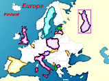
Europe Map Puzzle
     Learn the countries of Europe and their capitals.  Where is Moldova?  Free Software!
 

Learn to Read by Reading with:


Bridge to Reading


"When learning to read is fun, children read"
 

Beginning reading


We welcome all comments on your and your children's experience with our maps and software.
E-Mail us at:

Privacy Policy   -   Terms of Service

All Material Copyright 1998-2012 Owl and Mouse Educational Software

All pages and downloadable software may be freely used for individual and classroom instruction but may not be sold or redistributed.