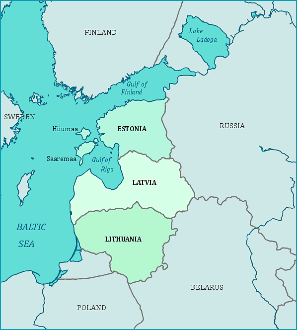
Print this map of the Baltic Region US States and Capitals Map Quiz
Free Maps, Map Puzzles and Educational Software: Owl and Mouse Educational Software
The Baltic states are on the east side of the Baltic Sea. The Baltic states include Latvia, Estonia and Lithuania, all of which gained independence from the Russian Empire after World War I. The Baltic states became part of the Soviet Union in the aftermath of World War II, and regained their independence from Russia in 1990-1991.
Estonia and Latvia each share a long border to the east with Russia. To the south of Estonia is Latvia; to the north is the Gulf of Finland and the Gulf of Riga is to the west. Estonia has two major (plus some smaller) islands to the west, Saaremaa and Hiiumaa, which are in the Baltic Sea. Latvia borders Russia to its east, Estonia to its north and Lithuania to its south. To the southeast is Belarus, once part of the Soviet Union. The large Gulf of Riga is to the north, while the west of Latvia faces the Baltic Sea. Lithuania has Latvia to the north, Belarus to the east, and Poland to the south, along with Kaliningrad (which is part of Russia). To the west, like all the Baltic states, is the Baltic Sea.
All three of the Baltic states were annexed by force to the Soviet Union in 1940. They were subsequently taken over by Nazi Germany in 1941, and then re-annexed by the Soviet Union in 1945 after the fall of Nazi Germany. Lithuania was the first to declare independence in 1990; all three had gained their independence by 1991.


