


Photo: Jean Tosti
Oregon grape — State Flower
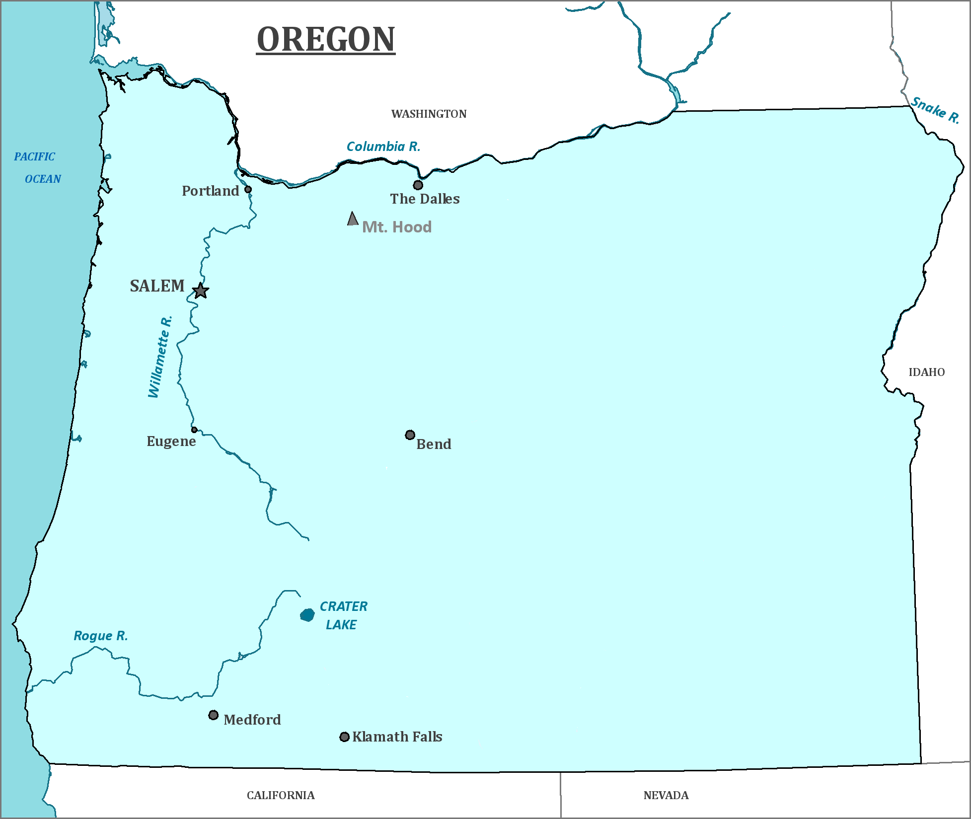
Oregon
Oregon is the middle state on the Pacific Coast of the United States and is the southern part of the Pacific Northwest.
Date first visited by Europeans: The land that would become Oregon was sighted by Juan Rodríguez Cabrillo in 1543; Sir Francis Drake landed in Oregon to repair his ship in 1579
Date admitted to US: 1859
Capital: Salem
Largest City: Portland
Terrain: The Columbia River forms the northern border with Washington, with which Oregon shares the Columbian River Estuary. Oregon is the home of Crater Lake, the deepest lake in the United States, which is in the remains of a dormant volcano.
While there are many variations in the state’s geography, the land west of the Cascade Mountains is much wetter than the portion of the state east of the mountains. This wet region is home to temperate rainforests.
The Willamette Valley, next to the coastal region is formed by the eponymous Willamette River and is 150 miles long. Nearly three-quarters of the state population lives in this valley, partially due to the ready water and fertile soil.
In contrast, east of the Cascades is a much drier climate, much of which is considered to be a part of the High Desert region. Despite the name, it is not a true desert and probably only seems arid in comparison to the much wetter part of the state. The region is more accurately described as a steppe or scrubland.
Area: 98,381 square miles
Area Rank: 9th
Population: 4,013, 845
Population rank: 26th
Electoral Votes: 11
Despite the region bearing the name Oregon for over a century, the origin of the name is highly debated. The earliest uses of the name indicate that it possibly of Spanish origin. It could be a possible reference to the herb Oregano, which grows in abundance in the southern portion of the state.
The Lewis and Clark expedition explored northern Oregon in 1805-1806.
Oregon, known then as the Oregon territory, was the eventual destination of settlers along the Oregon Trail. At first, the trail could only be travelled on horseback and was primarily for fur trappers seeking valuable pelts. Trails were made to bring wagons and settlers to Idaho and as time passed, the wagons and settlers pushed their way west and eventually were able to travel all the way to the Oregon Territory.
Oregon’s entrance into the Union was delayed due to the odd status of slavery within the state. Early on, the state refused to allow slavery, but also refused to allow African Americans to settle there. However, many people smuggled in illegal slaves to the frontier region. It was only when states in the Southwest were created as Slave states was Oregon finally a state.
Print this map of the United States US States and Capitals Map Quiz
Free Maps, Map Puzzles and Educational Software: Owl and Mouse Educational Software
