

Photo: Stan Shebs
Rocky Mountain Columbine — Montana State Flower
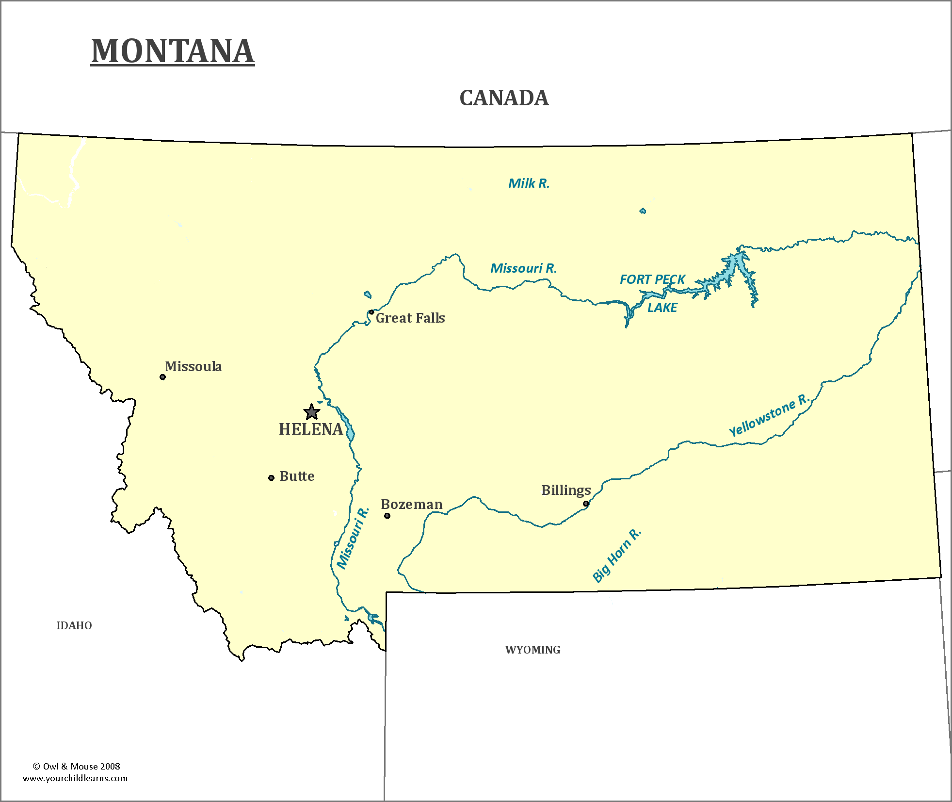
Montana
Montana is a landlocked state in the northwest region of the United States, sharing a long border with Canada to the north, Idaho to the west, North and South Dakota to the east and Wyoming to the south.
Date first visited by Europeans: Probably fur traders, who did not keep much in the way of records. The Lewis and Clark Expedition, which did, went through what is now Montana in 1804-1805.
Date admitted as a state: 1859
Capital: Helena
Largest City: Billings
Landscape: Montana goes from the Rocky Mountains to the Great Plains. The Continental Divide goes through Montana, and the western side of the state is mountainous. On the eastern side, mountains give way to badlands an plains. Montana's highest peak, Granite Peak, however, is east of the Continental Divide.
Area: 1147, 040 square miles
Area Rank: 4th
Population: 1,032,949
Population rank: 44th
Electoral Votes: 3
Montana's Triple Divide Peak, in Glacier National Park, is where water flows in three directions to the oceans—through smaller creeks and rivers to the Mississippi River, through New Orleans to the Gulf of Mexico; to the Columbia River and thence to the Pacific Ocean; or through Hudson's Bay Creek to St. Mary River and eventually to Hudson's Bay and the northern Atlantic. Rain or snow that falls around a single peak area can end up on the east or west side of the North American continent, or on the southern edge of it.
Montana, along with other states in the Rockies, is home to the endangered black-footed ferret, to Bighorn Sheep, and to Mountain goats, Bison and a number of other species.
Glacier National Park is in Montana, on the US-Canada border. It currently has 37 glaciers, which are retreating. Montana also includes part of Yellowstone National Park.
Print this map of the United States US States and Capitals Map Quiz
Free Maps, Map Puzzles and Educational Software: Owl and Mouse Educational Software
