
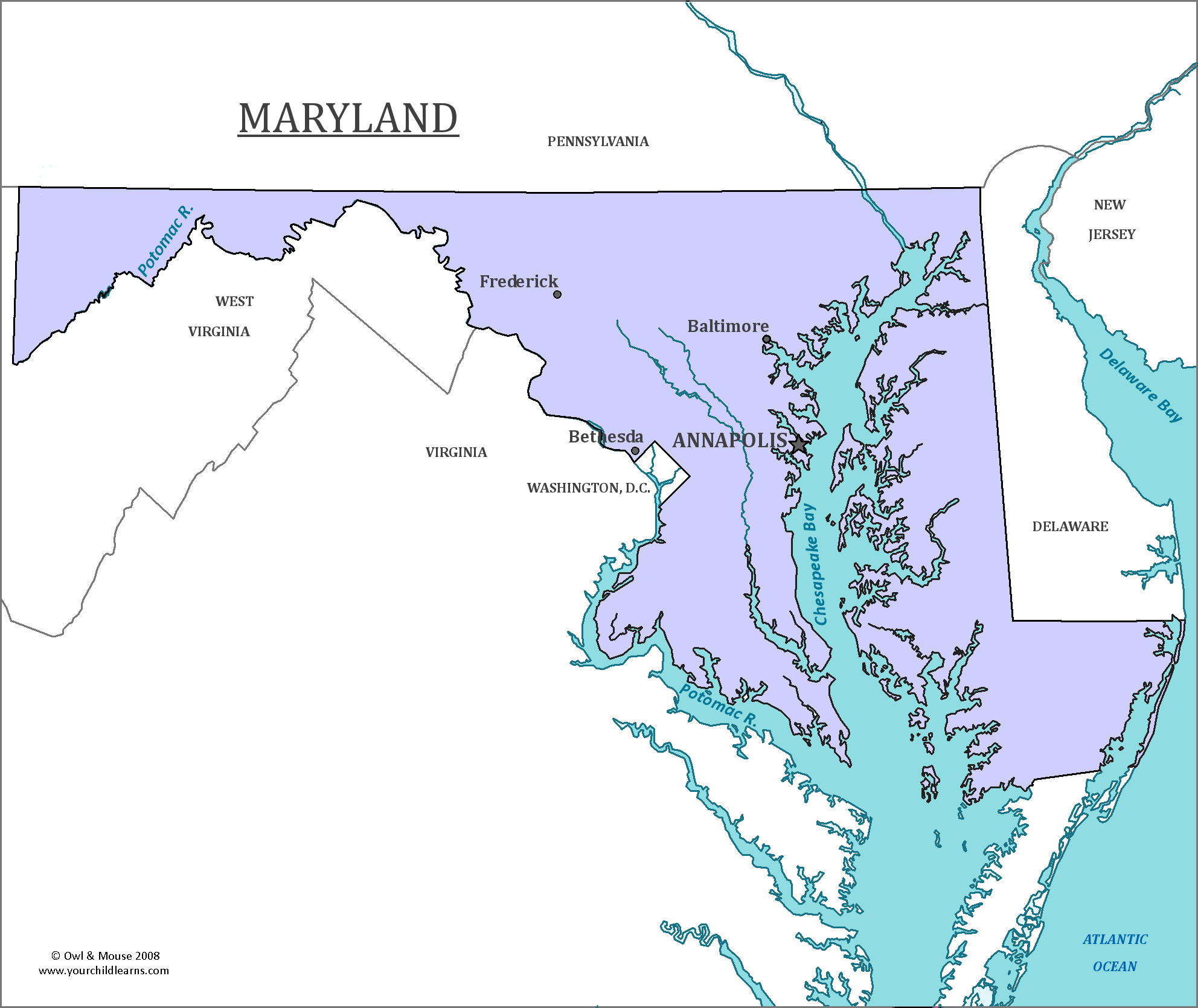

Maryland
The state of Maryland is in the mid-Atlantic region of the United States and is on the Atlantic Coast. The state is divided by the Chesapeake Bay, which separates the eastern portion of the state from the western half. The Delmarva Peninsula, which compromises much of the eastern half of the state is shared between Maryland, Virginia, and Delaware.
Date first discovered by Europeans: The exact date of Maryland’s discovery is uncertain. Some believe that Zuan Chabotto (Also known as John Chabot in English) successfully explored the coast in 1498 on his second expedition, but this is debated among scholars. Others believe that Giovanni da Verrazzano in 1524 was the first European to have explored the region.
Date admitted to US: 1788
Capital: Annapolis
Largest City: Baltimore
Terrain: Maryland has a variety of landscapes, from dunes near the Chesapeake Bay to oak or pine forests away from the ocean.
Maryland has a variety of topography, giving it is nickname of ‘America in Miniature’ as it encompasses so many types of terrain. The eastern region of the state has sand dunes and seagrass. The western portion of the state, however, has rolling hills and forests.
The Chesapeake Bay is the largest estuary in the United States. Many rivers and streams drain into it. Many marshes surround the bay, and are along the Atlantic Flyway, or a path commonly used by many migratory birds. It is home part of the year to Loggerhead turtles.
Area: 12,407 square miles
Area Rank: 42nd
Population: 5,976,407
Population rank: 19th
Electoral Votes: 10
Maryland started as the Maryland Province which was an English colony. The charter for the colony was granted to Cecil Calvert, 2nd Baron Baltimore in 1632. It was intended as a haven for Catholics, who were being persecuted in England. It was named for the Queen Consort Henrietta Maria, the Catholic wife of then King Charles I. Laws were passed to protect religious freedom for both Protestants and Catholics. However, there was much conflict between various Christian religions, which eventually led to a revolt in 1689 that ousted the current government and forbade Catholicism. Religious freedom protected by law would not return to the state until it signed the Declaration of Independence.
Maryland gave land to the Federal Government to form the District of Columbia, the US capital. The state of Virginia also donated land to the capital, but this land was seceded back to Virginia in 1846 due to various reasons, including neglect by Congress resulting in a lack of infrastructure, passing of laws to prevent major buildings being constructed across the Potomac river, and the desire to secure more votes for continuing slavery, as the portion of the District Columbia that was donated from Virginia was a major area for slave trading and would continue to support slavery.
The national Anthem of the United States was written during the war of 1812, when Francis Scott Key was held by British forces when he was trying to negotiate the release of American prisoners. It was not formally adopted as the official National Anthem of the United States until 1931, through it was one of several unofficial anthems in use, which also included ‘Hail Columbia’ (which is now used for the Vice-President) and ‘My Country tis of thee’.
Print this map of the United States US States and Capitals Map Quiz
Free Maps, Map Puzzles and Educational Software: Owl and Mouse Educational Software
