

Photo: Darwinek
Peony — Indiana State Flower
Indiana
Indiana is located in both the Midwestern and Great Lakes regions of the United States. Indiana was part of the Northwest Territory, which was northwest of the Ohio River. Until the early 19th century, Indiana was at the edge of the American Frontier.
Date first discovered by Europeans: Rene-Robert Cevelier, Sieur de la Salle entered what is now Indiana in 1679. The French explorer had heard of the Ohio River from the Mohawk Indians and had incorrectly assumed it flowed into the Gulf of Mexico.
Date admitted to US: 1818
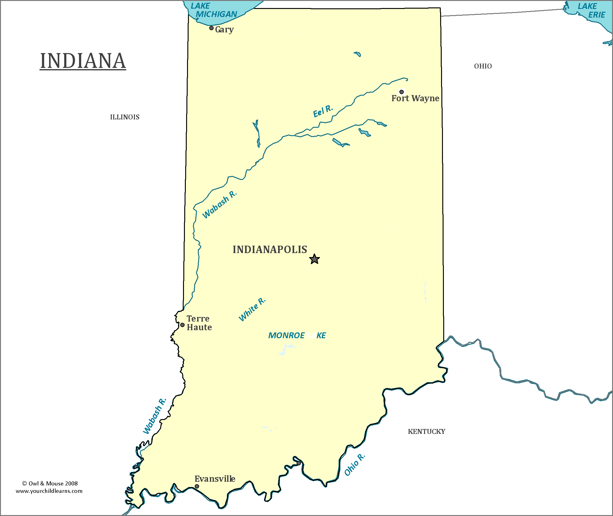
Capital: Indianapolis
Largest City: Indianapolis
Terrain: Northern Indiana is made of Till Plains, which are plains that are formed from glaciers melting and depositing sediment, making for a flat area with rolling hills.
Southern Indiana is more hilly then the north, and has more varied topography than the North. The most rugged terrain in Indiana, the Knobstone Escarpment, is in the South.
Along the shoreline of Lake Michigan are sandy beaches and sand dunes. Several rivers are in Indiana, including the Whitewater, White, Blue, Wabash, St. Joseph, and Maumee rivers.
Area: 36, 418 square miles
Area rank: 38th
Population: 6,596,855
Population rank: 16th
Electoral votes: 11
Indiana was one of the states that comprised the Northwest territory, a region of land seceded to the United States of America in the Treaty of Paris, the treaty that ended the American Revolutionary War. The territory included land that would later compromise the states of Ohio, Illinois, Michigan, Wisconsin and Minnesota.
Indiana was the site of only one battle in the Civil War, the Battle of Corydon, which involved 400 union soldiers. However, throughout the war over 200,000 men from Indiana served in the war.
Madam C. J. Walker was an entrepreneur and philanthropist who was born into a slave household in 1867. Despite this, she became one of the wealthiest women of her time after starting her own business in Indianapolis in 1910. She donated generously to the the National Association of Colored People (NAACP).
In 1925, it was revealed that the Indiana Klan, a branch of the Ku Klux Klan, had bribed and controlled many politicians within the Indianan Government. Grand Dragon D. C. Stephenson had been convicted of murdering German-American Madge Oberholtzer; he revealed several prominent members of the organization and details of who they had bribed. This led to a loss of reputation and political power for the Klan, which was no longer seen as morally upright or law-abiding.
Print this map of the United States US States and Capitals Map Quiz
Free Maps, Map Puzzles and Educational Software: Owl and Mouse Educational Software
