Map of Colorado, major cities, states and capitals


Colorado state flag
Colorado State Flag

Colorado state flower

Photo: Stan Shebs

Rocky Mountain Columbine — Colorado State Flower
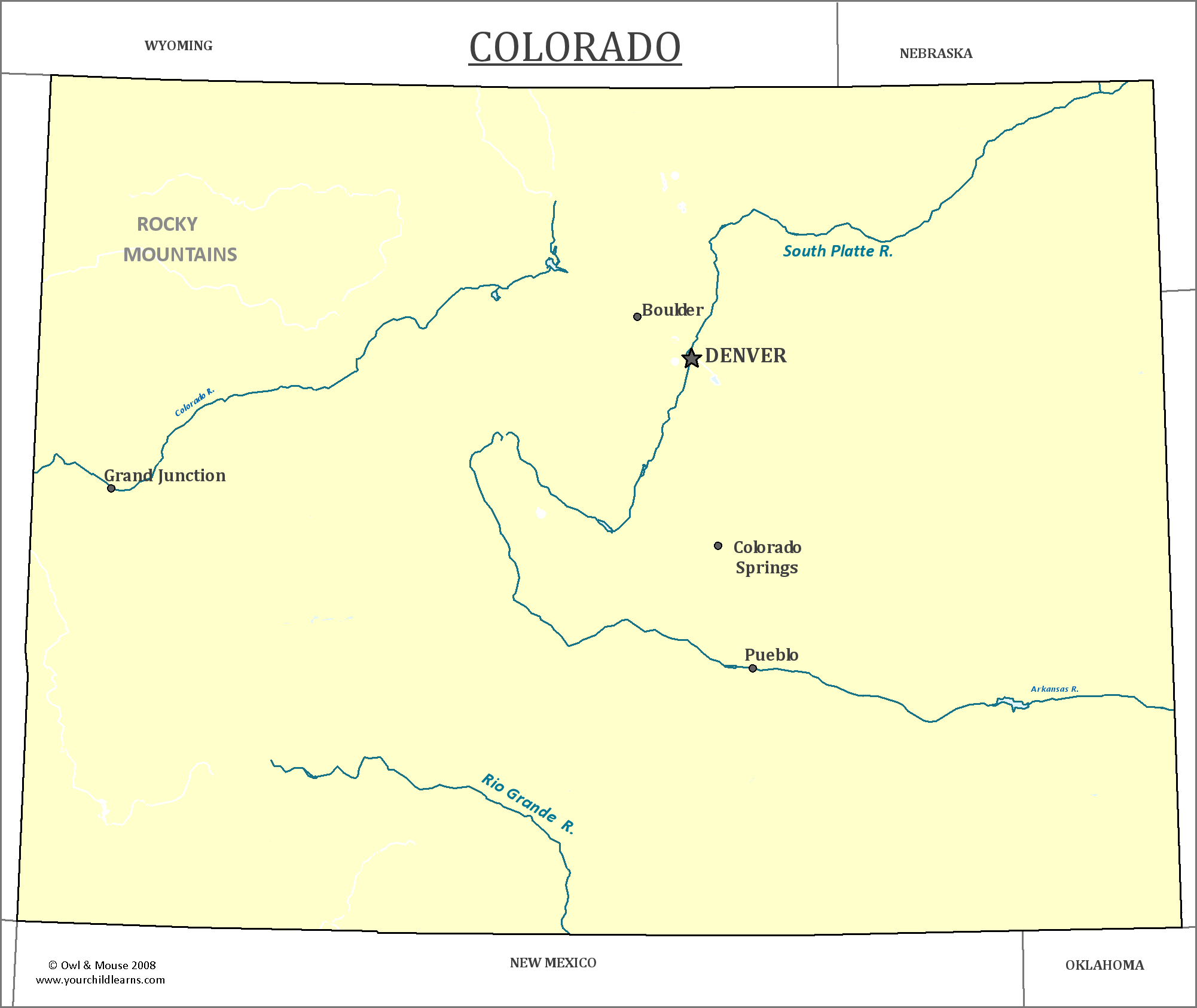
Colorado

Colorado is located in the western United States, but its central position makes it a part of the Western United States, the Southwestern United States, and the Mountain States all at once.
  Date first discovered by Europeans:  Juan de Oñate led an expedition in 1598 to claim land for the Spanish empire, and established the province of Santa Fe de Nuevo México which included land that would become southern Colorado.
  Date admitted to US: 1876
  Capital: Denver
  Largest City: Denver
  Terrain: Eastern Colorado is part of the Great Plains, while Western Colorado is in the Rocky Mountains.  The Continental Divide runs North-South through the state.
  Area: 104,094 sq mi
  Area rank: 8th
  Population: 5,456,574
  Population rank: 22nd
  Electoral Votes: 9

  Colorado has the highest incorporated city (population 2,602) in the continental US, Leadville, which was a silver mining town. All of the state lies at least 3,000 feet (or a little over 1,000 meters) elevation, making it one of the highest states.
 

Quill's Quiz - 1100 Question US Mega Geography Quiz
Print this map of the United States     US States and Capitals Map Quiz  
Free Maps, Map Puzzles and Educational Software: Owl and Mouse Educational Software


Search Owl & Mouse:
We welcome all comments on your experience with our maps and software.
E-Mail us at: "Owl and Mouse" <owlmouse at yourchildlearns dot com>
All Material Copyright 1998-2021 Owl and Mouse Educational Software except as noted.
All pages and downloadable software may be freely used for individual and classroom instruction but may not be sold, redistributed or reposted without permission.
Javascript and CSS coding by Ashton Shapcott.
Privacy Policy    Terms of Service    About Us

We have maps, map puzzles and US geography quizzes for learning geography, and activities for teaching early reading.