
Quill's Quiz - 1100 Question US Mega Geography Quiz
Print this map of Timor-Leste US States and Capitals Map Quiz
Free Maps, Map Puzzles and Educational Software: Owl and Mouse Educational Software
Print this map of Timor-Leste US States and Capitals Map Quiz
Free Maps, Map Puzzles and Educational Software: Owl and Mouse Educational Software
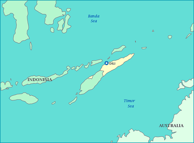
Timor-Leste
Timor-Leste is officially known as both the Republic of Timor-Leste and as East Timor; both names being redundant with both names meaning 'east east'. Legends say that the island was created when a magic crocodile transformed himself into the island to repay a young boy. Those who have traveled outside of the island, for whatever reason, have referred to it as 'leaving the crocodile'.
The country was a major trading partner with China and India for centuries. The country remained more or less undisturbed until the arrival of the Portuguese sometime between 1509 and 1511as records vary. Despite the early arrival, the land was not settled by Europeans until 1556 when Dominican friars arrived, followed by traders. Soon Portugal laid claim to the area and its trade route, declaring it Portuguese Timor. Portugal held the countrywith a slight gap when the Japanese took over in WWII, only to surrender the country back to Portugaluntil it was finally forced by the 1974 Portuguese Revolution causing Portugal to decolonize in late 1975, which was immediately followed by the country declaring independence.
Freedom was short-lived, as Indonesia invaded the same year in an attempt to prevent a communist takeover. With help from Portugal, the UN, and Australia, peace was restored and Timor-Leste became a sovereign nation in 2002 and over 250,000 refugees returned home. The Indonesian occupation has been remembered as a violent, brutal, and bloody war in which at least 102,800 people died. Peace again had to be restored with international help in 2008 after a presidential assassination, with peacekeeping efforts ending in 2012.
Timor-Leste's economy is dependent mainly on a few commoditiescoffee, marble, and sandalwood, leaving half the population in poverty. The country has been labeled as 'most oil dependent' in regards to its economy by the IMF, as petroleum sales fund nearly the entire annual budget for the government. Under Indonesian control, the use of the Portuguese language was banned. It remains highly popular today and is one of the official languages of the country, along with Tetum, the native dialect. 96.9% of the population is Catholic, with a remaining 2.2% Protestant and 0.3% Muslim.
Total area: 228 sq km
Population: 1,201,542
