
Quill's Quiz - 1100 Question US Mega Geography Quiz
Print this map of Guyana US States and Capitals Map Quiz
Free Maps, Map Puzzles and Educational Software: Owl and Mouse Educational Software
Print this map of Guyana US States and Capitals Map Quiz
Free Maps, Map Puzzles and Educational Software: Owl and Mouse Educational Software
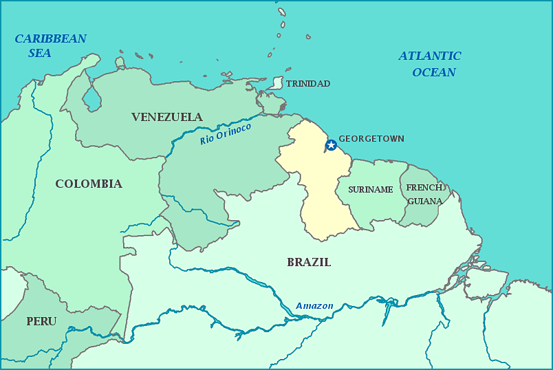
Guyana
The Co-Operative Republic of Guyana was originally inhabited by native tribes, such as the Wai Wai, Machushi, Patamona, Arawak, Carib, Wapishana, Arecuna, Akawaio, and Warrau until the Netherlands established a colony in 1616. The Dutch opened up the colony to the British in 1746. So many British settlers moved in that by 1786, the colony was subsumed into British control. The Dutch officially ceded the colony to Britain in 1814. The colony grew to claim what is now Suriname, French Guiana, and parts of Columbia, Venezuela, and Brazil. When Venezuela became independent, the new country claimed all land west of the Essequibo River, sparking a dispute that still persists to this day, even after an 1899 tribunal ruled in favor of Great Britain. The country negotiated independence in 1966 and became an official republic in 1970.
In 1978, members of the People's Temple, an American cult, fled to Guyana. When Leon Ryan, an America congressman, went to investigate, cult leader Jim Jones order his bodyguards to have Leon killed, shortly before conducting a mass cult suicide. Using flavored water and liquid sedatives and cyanide, 914 people died: 638 adults and 276 children. A few were shot or fled into the jungle, never to be heard from again.
Guyana's mountains are said to have inspired Sir Arthur Conan Doyle's book Lost World. The country sees a hot and humid climate with two rainy seasons and is is famous for one of largest unspoiled rainforests in the world, home to 1,168 vertebrate species, including 814 birds and the mammals per square foot in the world. Over 70% of wildlife habitats remain pristine. Currently, the country is embroiled in a dispute with Suriname over the Courantyne, as well as with Venezuela over the Essequibo river. Most of the population speaks Guyanese Creole, an English-based languages with loanwords from India, native dialects, and Dutch.
Area: 214,469 sq km
Population: 735,554
