
Quill's Quiz - 1100 Question US Mega Geography Quiz
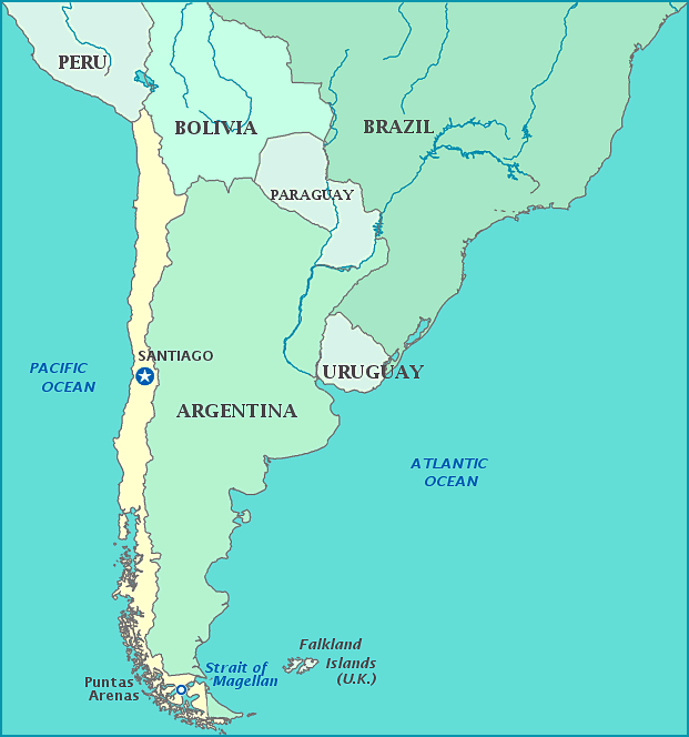
Print this map of Chile US States and Capitals Map Quiz
Free Maps, Map Puzzles and Educational Software: Owl and Mouse Educational Software
Print this map of Chile US States and Capitals Map Quiz
Free Maps, Map Puzzles and Educational Software: Owl and Mouse Educational Software
The Republic of Chile claims the islands of Islas Desventuradas, Salas Gomez island, Easter Islands, Robinson Crusoe Island, Juan Fernandez island, San Ambrosio Island, San Felix Island, and 1,250,000 square kilometers of Antarctica (this has never been recognized).
The region was inhabited over 10,000 years ago, with the Inca moving in only in 1,000 BCE, followed by the Spanish in 1525. Neither the Inca nor the Spanish were welcomed by the native Mapuche—called Auracanas by the Spanish. Though undaunted by the resistance from all native groups, the Spanish did not begin conquering the region until 1540, taking advantage in the disunity among tribes and using superior weaponry, only to find neither silver nor gold. The natives were resilient, with insurrections 1553, 1598, and 1655, destroying several settlements in retaliation. After the British tried to raid what was left of the Spanish colonies, Chile became the most militarized of Spanish possessions, severely draining the treasury back home.
Napoleon took advantage of the distracted and drained mother country, taking action when Chile declared independence, by appointing his brother as King of Spain, who refused to recognize the declaration and tried to re-instate Spanish rule in 1808, only to see utter defeat in 1818. Following its triumph and separation from Europe, the new country set about expanding its borders, leaving massive deforestation in its wake. To compensate, the government issued monetary incentives to repair the forest and introduce pollinators via harvesting honey. This led to an expansion of the middle class, who became inspired by the Marxist's motto 'Bread, A roof, and Work!'.
True to their word, the Marxist party passed many reforms for the social good, including laws to protect factory workers, higher pensions for widows, maternity care, and free lunch for schoolchildren. Most of this was thanks to Salvador Allende, who served as Minister of Health at the time. He continued his efforts as a long-term president, being elected in 1952, 1958, 1964, and 1970. His deeds earned the ire of both the Chilean military and the US, prompting the latter to assassinate the head of the military in an effort to strong-arm Allende. In 1973, the US aided in a violent coup against Allende, creating a regime that killed over 2,000 people, and tortured over 27,000, including 88 young children. The country only began to recover and reinstate human rights after another economic disaster in 1982 and civil resistance for the following 5 years. Since then, Chile has made a miraculous recovery; it is now one of the most prosperous and stable countries in South America and leads in human development, competitiveness, income per capita, globalization, state of peace, economic freedom—the highest in South America, and lowest perception of corruption in the continent.
The country sits upon the Pacific Ring of Fire, which has pushed tectonic plates together to form the Andes and often causes earthquakes along the coast. It is the longest country, from north to south, in the world. Most than 80% of the country is mountains; Ojos de Salado, the highest point in Chile, is the tallest volcano in the world (from sea level). Many native plants and animals are specific only to Chile due to geographic isolation due to the Andes and the northernmost region coming closest to an absolute desert in the world. Chile produces 1/3 of the world's copper and is home to Escondida, the world's largest copper mine.
