
Print this map of Cameroon US States and Capitals Map Quiz
Free Maps, Map Puzzles and Educational Software: Owl and Mouse Educational Software
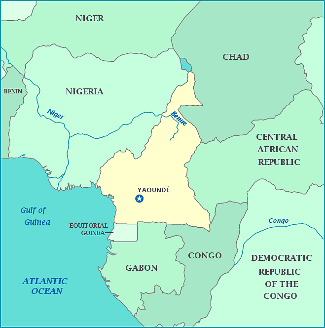
Cameroon is in the “corner” of west Africa, facing the Bight of Biafra, also known as the Bight of Bonny, where the coast of Africa turns from east-west to north-south. Cameroon has Nigeria to its west, Chad to the northeast, Central African Republic to the east; and Republic of the Congo, Gabon and Equatorial Guinea to the south. The northern tip of Cameroon borders Lake Chad. Its capital is Yaounde. Officially the Republic of Cameroon or Republique Du Cameroon in French, Cameroon is nicknamed ‘Little Africa’ for its cultural and geological diversity The country is home to 200 distinct linguistic groups. Cameroon was claimed by Germany, and then split between France and Britain after WWI. On January 1, 1960, Cameroon gained independence from France.
In 1986, Lake Nyos, a volcanic crater lake in northern Cameroon, became saturated by CO2 from the volcano and exploded, emitting a large cloud of CO2 which suffocated 1700 people in its path.
