
Print this map of Burundi US States and Capitals Map Quiz
Free Maps, Map Puzzles and Educational Software: Owl and Mouse Educational Software
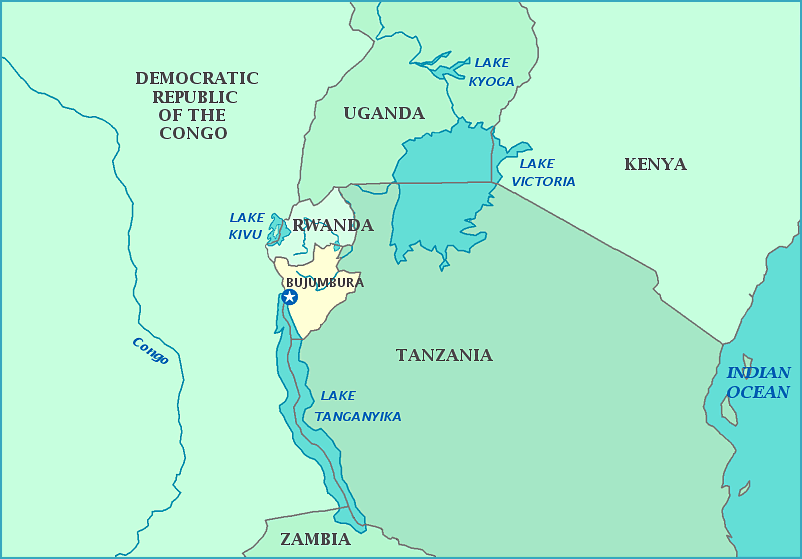
Burundi is a very small country in the lower middle of Africa. Burundi is south of Rwanda; it has the Democratic Republic of the Congo to its west and Tanzania to the east. Lake Tanganyika forms part of its border on the west. The capital of Burundi is Bujumbura.
Burundi was formerly claimed by Germany before WWI, and later Belgium. It gained independence on July 1, 1962, as well as taking its current name. Before independence, Burundi was part of Burundi-Rwanda, which included what is now the country of Rwanda. Two months after independence, the country joined the UN. All was not well, however; as the elected president of Burundi, Ndadaye, was assassinated in 1993, triggering a civil war between two major ethnic groups, the Hutu and the Tutsi. An estimated 250,000 people have died in tribal wars for control of the country. Burundi has among the lowest per capita income in the world. Burundi is one of the poorest nations in Africa.
