
Print this map of Algeria US States and Capitals Map Quiz
Free Maps, Map Puzzles and Educational Software: Owl and Mouse Educational Software
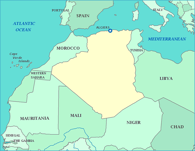
Algeria was once inhabited by prehistoric peoples, who left cave paintings in Tassli N’Ajjer. The country has been ruled by many dynasties, empires, and countries including the Aterians, Capsians, Numidians, Carthaginians, Romans, Vandals, Byantines, Umayyads, Fatimids, Almohads, Ottomans, Spanish, Berbers, and French until its independence from France in 1962. Throughout history, Berbers have ruled the country for longer than any other place or people. Coastal cities have been major ports in the slave trade under several different rulers. The French claim was a major tragedy for the country, as one third of the population died as the territory was conquered in 1830 and 50,000—150,000 thousand people were killed in the revolution that led to independence. It is home to the largest oil company in Africa. The highest peak is Mount Tahat. Located on the coast of the Mediterranean, the country in the largest in Africa, with 90% of it part of the Sahara desert.
Population: 33,087,812 [2013 est.] Area: 2,381,741 km2
