
Quill's Quiz - 1100 Question US Mega Geography Quiz
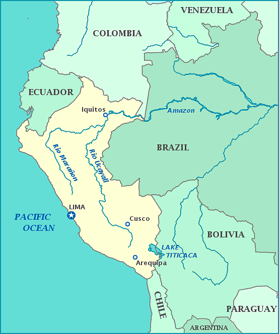
Print this map of Peru US States and Capitals Map Quiz
Free Maps, Map Puzzles and Educational Software: Owl and Mouse Educational Software
Print this map of Peru US States and Capitals Map Quiz
Free Maps, Map Puzzles and Educational Software: Owl and Mouse Educational Software
The earliest civilization to reside in what is now the Republic of Peru began in 9,000 BCE. In the 12th century CE, the Inca moved in, absorbing smaller tribes. Eventually the Inca moved in, absorbing smaller tribes into their empire, which was the largest in Mesoamerica and lasted from the 12th century to the 16th. Inca rule was ended swiftly when the Spanish arrived 1532 and took advantage of a civil war, capturing the King Atahualpa, the last ruler of the empire. While this was the most important conquest in Spanish conquest of the Americas, native resistance was not put down completely until 1572.
Under Spanish rule, the cause of death for most natives was illness brought by their European overlords, followed by poverty and exploitation. Those who were left were forced to mine silver and gold once the Spanish discovered ores. To increase the dwindling work force, African slaves were brought over. Although the Spanish tried hard to repress native religions to the point of torture and death, many cultures form Africa and South America were integrated into Peruvian Catholicism. When the idea of independence began to spread, with Brazil, Argentina, and Chile already eager to be free, Spain appointed Jose de la Serno as commander in chief to keep Peru safe. Instead, Jose sided with the rebels and declared independence in 1821, winning it a year later.
By the 1840's the country began to focus on economics, for good and for bad. Guano became a major export, creating stability within the country for 30 years, until the resource began to run out. The country soon became heavily indebted, causing extreme in-fighting until the country made the mistake of joining the War of the Pacific. The War lasted from 1879-1884, caused a drain on the economy, and lost the Tarapaca department and Tacna and Arica provinces to Chile (Tacna was returned in 1929). Political and economic stability returned in the 1900's, but violence returned in the following decades, both within following the Great Depression with coups and dictatorships, and without with Columbia in 1932-1933 and Ecuador in 1941. Until 1975, civil rights were restricted and political fraud was rampant elected and self-proclaimed rulers.
