Quill's Quiz - 1100 Question US Mega Geography Quiz
Print this map of Malawi US States and Capitals Map Quiz
Free Maps, Map Puzzles and Educational Software: Owl and Mouse Educational Software
Print this map of Malawi US States and Capitals Map Quiz
Free Maps, Map Puzzles and Educational Software: Owl and Mouse Educational Software
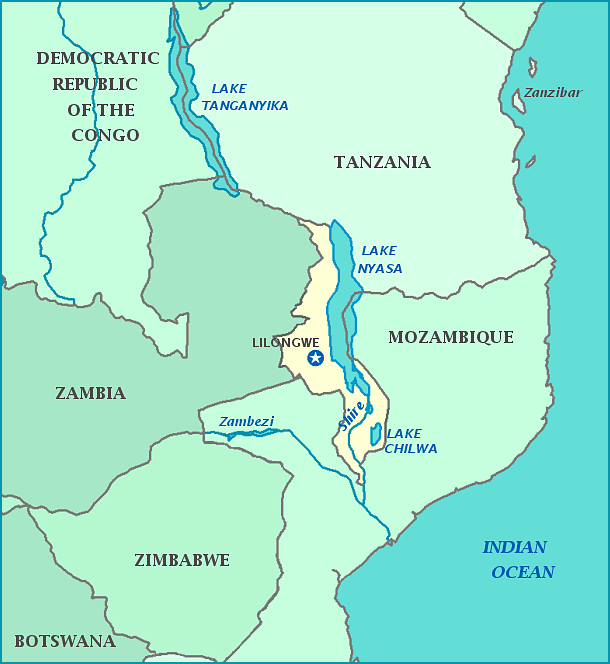
Formerly known as Nyassaland, Malawi is now officially known as the Republic of Malawi. It lies along the west side of Lake Nyasa, in the southern portion of Africa. The area was first colonized by the Bantu who had united by 1600 and begun trading with the Portuguese traders that set up trading posts. The Bantu continued to rule until the area was claimed by the British in 1891. Hastings Banda was a nationalist who protested for independence and nationalism; he was subsequently jailed for his efforts. The country became semi-independent in 1953 and fully independent in 1964 after the dissolution of the Central African Federation; the name change followed immediately afterwards. Banda was released from jail; he went on to help form the constitution, adding the law that African natives must hold the majority of congressional seats. The country declared itself a single-party state from 1953-1994, but has since been a democracy. Currently, the country is lead by Joyce Banda—not related to Hastings Banda—the first woman to lead the country. By 2008, tribal disputes had mostly dissolved and citizens identified themselves more as Malawians than their tribe. Over a third of the national GDP and 90% of exports derive from agriculture, which focuses mainly on tea, coffee, sugar, and especially tobacco. More and more stringent laws against tobacco use mean the country might face an economic crisis, thus the government encourages growers to switch to hemp plants. Malawi is home to Calendar Lake, so named as it is 365 miles by 52 miles.


