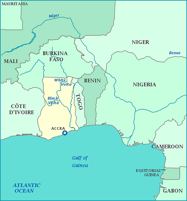
Print this map of Ghana US States and Capitals Map Quiz
Free Maps, Map Puzzles and Educational Software: Owl and Mouse Educational Software
Ghana is on the Atlantic Ocean, near the Bight of Biafra, with a coastline facing south. While the legacy of the Ghana empire is rich and detailed since the Bronze Age, most knowledge of what is now the country of Ghana comes from after European colonialism as it was mostly unsettled until the 11th century. Europeans built forts and trading posts along the coast. Later the English claimed the entire territory to monopolize the trade and resources. In 1874, Britain took full control of the country and claimed the territory as a protectorate. The country was the first sub-Saharan country to gain independence in 1957, a few short years after 65,000 Ghanaian troops lost their lives fighting on the side of the Allies. The first Prime Minister, Kwame Nkrumah, promoted pan-Africanism, an anti-racial idea to unite all of Africa and accept all creeds, tribes, nations, etc. While his original goal failed, Nkrumah created the African Union and Organization of African Unity. Nkrumah was overthrown in one of the successive coups aided by the CIA, which ended with John Rawlins as president. Rawlins suspended the constitution, banned political parties, and caused an economic collapsed and caused a mass emigration from the county. A new constitution was created in 1992 and multi-party elections were reestablished. 20%-48% of the national budget has gone into education in the last decade, and Ghana has the highest high school enrollment percentage in Africa. All teaching is done in English. The country has only two seasons—wet and dry—and is the closest to latitude 0° and longitude 0°.


