Find more free maps and free educational software at Owl & Mouse

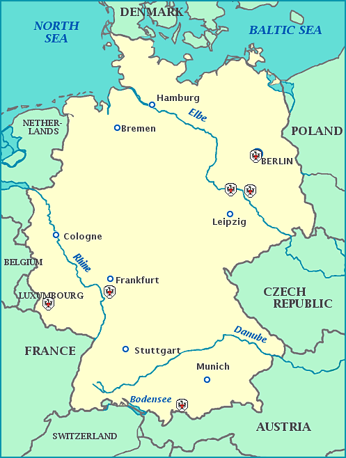
     Germany is in the center of Europe, facing the North Sea, Denmark and the Baltic Sea to the north; Poland and the Czech Republic to the west; Austria and Switzerland to the south and France, Luxembourg, Belgium and the Netherlands to the west.  Germany borders more European countries than any other European country.  From the end of World War II until 1990 Germany was divided into West Germany, allied with NATO and a part of the European Union, and East Germany, dominated by the Soviet Union and a part of the Warsaw Pact.  Germany has the largest economy and second largest population in Europe.


Find more Free Maps at our Maps and Geography Page


Map of Germany, showing sites of events important in European history.
More Maps of Europe
 

Guttenberg - Moveable Type

Guttenberg printed the first book done with moveable type in Mainz.

Luther - 95 Theses

Wittenberg - Luther posted his “95 Theses” on the church door, setting off the Protestant Reformation.

Berlin Wall

From 1961 to 1989, the communist government put up a wall to keep the people of East Berlin from going to West Berlin.

Trier

Trier is probably the old city in Germany, (a city, as opposed to a camp or small settlement), founded approximately 16 BC.  It is the oldest seat of a bishop north of the Alps.

Dessau

Center of the Bauhaus movement in architecture and design.

Neuschwangan Castle

New Swan Castle built by Ludwig II, in a superb alpine setting.


© Owl and Mouse 2007