
Quill's Quiz - 1100 Question US Mega Geography Quiz
Print this map of Brazil US States and Capitals Map Quiz
Free Maps, Map Puzzles and Educational Software: Owl and Mouse Educational Software
Print this map of Brazil US States and Capitals Map Quiz
Free Maps, Map Puzzles and Educational Software: Owl and Mouse Educational Software
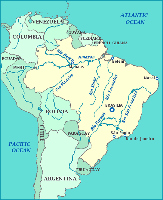
Officially named the Federative Republic of Brazil; Brazil is the largest country in both South and Latin America, fifth largest in the world, and the largest Portuguese-speaking country in the world. It is so large that it spans 3 time zones, taking up nearly half of the continent and borders all other South American countries except Ecuador and Chile. Its name derives from brazilwood, a tree that grew abundantly along the coast when the Portuguese arrived.
The earliest human remains are 11,000 years old, the skeleton named Luzia Woman. By 1500, when the Portuguese arrived, the Inca ruled over 7 million people. The Portuguese were quick to set up plantations worked by slaves; by the 16th century sugarcane was the most important export and slaves were the most important import until the 1690 gold rush. Portugal was forced to take a more active role in its new colony as other countries sought to settle and exploit the land; the French tried to take part of the colony in the 1560's and 1610's, and the Dutch in 1601-1661. Napoleon took over the capital of Portugal in 1807, ending Portugal's monopoly on Brazil and forcing the Royal family to flee to their South American colony. Seven years later, the Royal family returned, leaving their son, the prince, in charge of Brazil. However, ever since the loss of the throne, throughout South America the desire for independence began to spread and the prince sided with them and was crowned Prince Pedro of the Brazilian Empire in 1822. Fighting continued for Brazil; Portugal continued to fight until 1824, and Uruguay fought for independence from Brazil in the Cisplatine War from 1825-1827, followed by two more wars, the Patine, Uruguayan, and Paraguayan—the most devastating war in Brazilian history. The slave trade was abolished in 1850 and slavery ended in 1888.
Fed up with economic stagnation and military attrition, the monarchy was over thrown in 1889. The army controlled political power and freedom of the press with heavily controlled elections, yet civilians took control in 1894. Dictatorship returned with President Vargas, who seized power, promising temporary control, but instead closed congress and extinguished the constitution. Despite attempts to remove Vargas in 1932, 1935, and 1938, harsh dictatorship, even without him, continued until 1979, when the Amnesty Law was passed, finally ending practice of torture, murder, 'disappearances' and suppression of human rights.
Most of the Amazon River flows through Brazil, with the mouth spewing so much freshwater off the Brazilian coast, surface water is drinkable for 200 miles. Most of the country sees a tropical climate, often rainy and humid, making for some of the highest biodiversity ever seen on the planet. Much of this wildlife is threatened by illegal logging, mining, resettlement, fuel extraction, overfishing, smuggling of exotic species, dams, climate change, fire, and invasive species.
