
Quill's Quiz - 1100 Question US Mega Geography Quiz
Print this map of the the Bahamas US States and Capitals Map Quiz
Free Maps, Map Puzzles and Educational Software: Owl and Mouse Educational Software
Print this map of the the Bahamas US States and Capitals Map Quiz
Free Maps, Map Puzzles and Educational Software: Owl and Mouse Educational Software
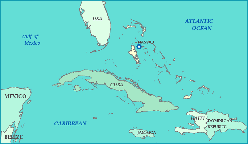
Bahamas
The Commonwealth of the Bahamas consists of 700 coral-based islands in the Lucayan archipelago in the Caribbean Sea. The islands were originally inhabited by the Lucayan people, who forced out the Taino tribes.
The islands have been settled by Amerindians, then Spain, France, and Britain. The Spanish enslaved the natives (those who had survived diseases brought by the Spanish) and shipped them off to nearby islands the Europeans to work on plantations. So many were enslaved that from 1513 to 1648 the islands were completely deserted of people. Eventually the Spanish named the islands 'Baja Mar', meaning 'Shallow Sea'.
In 1648 Britain showed interest in the lands, and settled colonies, renting them to the Lords and Proprietors of the North American Carolinas in 1670. Under English control, the islands soon became a refuge for privateers and pirates, including the infamous Blackbeard. Britain declared the islands a Crown Colony in 1718 to end piracy; despite most of the population being black slaves on plantations, the main income was from pirate raids on ships and ports, including ones in the Bahama islands themselves.
In 1720, The Spanish attacked, eager to reclaim the islands. It wouldn't be until the American Revolution that they'd regained control, and only after American forces stormed the capital and gave sovereignty to Spain just to spite Britain. Spain was forced to return the islands to Britain in 1782. Britain granted the Spanish plantations to British citizens and brought in more African slaves for labor. In 1807, Britain ended the slave trade and settled all slaves from ships encountered by British traders in the Bahamas as well as American slaves who fled during the Seminole Wars.
Today, the islands are one of the most prosperous countries in the West Indies. 85% of the population is of African descent, 12% European descent, 3% Latin American descent. The people enjoy a consistent tropical climate, with no reported frost or freeze anywhere.
Area: 13,880 sq km
Population: 321,834
